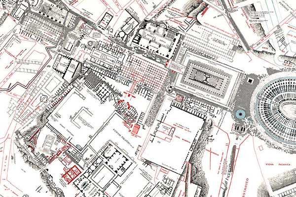
The topographical atlas by Rodolfo Lanciani, which was published in 1901, is a series of forty-six detailed plates measuring 25 by 36 inches, with ancient Rome outlined in black and the modern city plotted in red. The original plates were drawn at 1:1000 scale. In 1990, the atlas was reprinted by Edizioni Quasar at 1:2000 scale, its numbered sheets folded and presented in a slip case.
In this large detail from Plate 29, one can see the Roman Forum, with the Palatine below, the Temple of Venus and Rome, and the Colosseum.
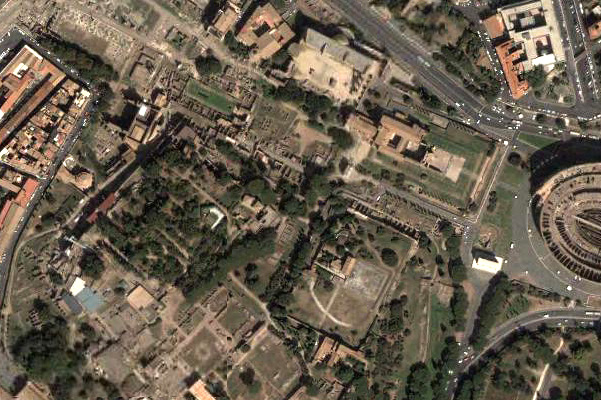
Compare this satellite view on Earth Google taken from thirty-five hundred feet.